The Salt Lick Point hiking trails near Valmeyer, IL should be on the radar for all St. Louis area hikers. Located just 20 minutes from south St. Louis County, the nature reserve offers a few short trails through a variety of terrain. I was in search of a unique trail with with some good hills close to home, and this proved to be the perfect choice on a late April day.

Quarantine hike
I arrived in the parking lot mid-morning on a Sunday smack in the middle of the COVID-19 pandemic. Like every other trail near St. Louis these days, the lot was already full of cars as people sought an escape from their homes and quarantine. A bit aggravated, I still found a place to park and quickly set out up the big hill on the Salt Lick Trail. The short 1.8 mile loop wastes no time going straight up to the top of the bluff overlooking the Monroe County farmland and the Mississippi River valley. The loop itself passes through mixed hardwoods, glades, and a few caves and mine shafts. If you only had time for this short walk then it would be totally worth it.


But it would also be a shame as the other trails at Salt Lick Point are spectacular. The Salt Lick Trail meets the Newman Trail near a nice bench in the woods. You can choose to follow the Newman Trail another 2 miles and then backtrack. Another option is take the Newman Trail until it meets the Johnson Trail. This route brings you back downhill and returns to the original trailhead. On this day I took the Newman Trail for another 1/2 mile or so along the top of the bluff, and enjoyed a pair of bald eagles sitting in the tall oaks near the trail. It was a nice change actually looking down on an eagle for once.


After viewing the very cooperative eagles, I backtracked and continued on the Salt Lick Trail loop. The trail passes through ‘Plasterer’s Glade’ and offers a vista of the surrounding woodlands. Quite a contrast from the glade on the other side facing the river valley but both wonderful. Photos from both glades are below:


Johnson Trail
Back at the trailhead, I opted to take the flat yet scenic Johnson Trail in search of spring wildflowers. This trail follows the base of the bluffs and offers some very worthwhile views. But for me this time of year the attraction is the variety of wildflowers that fill the forest floor. Celandine poppy, columbine, bluebells, jack-in-the-pulpit, larkspur, and fernleaf phacalia are plentiful. The flowers cover the ground and flow over the top of the large boulders interspersed throughout.


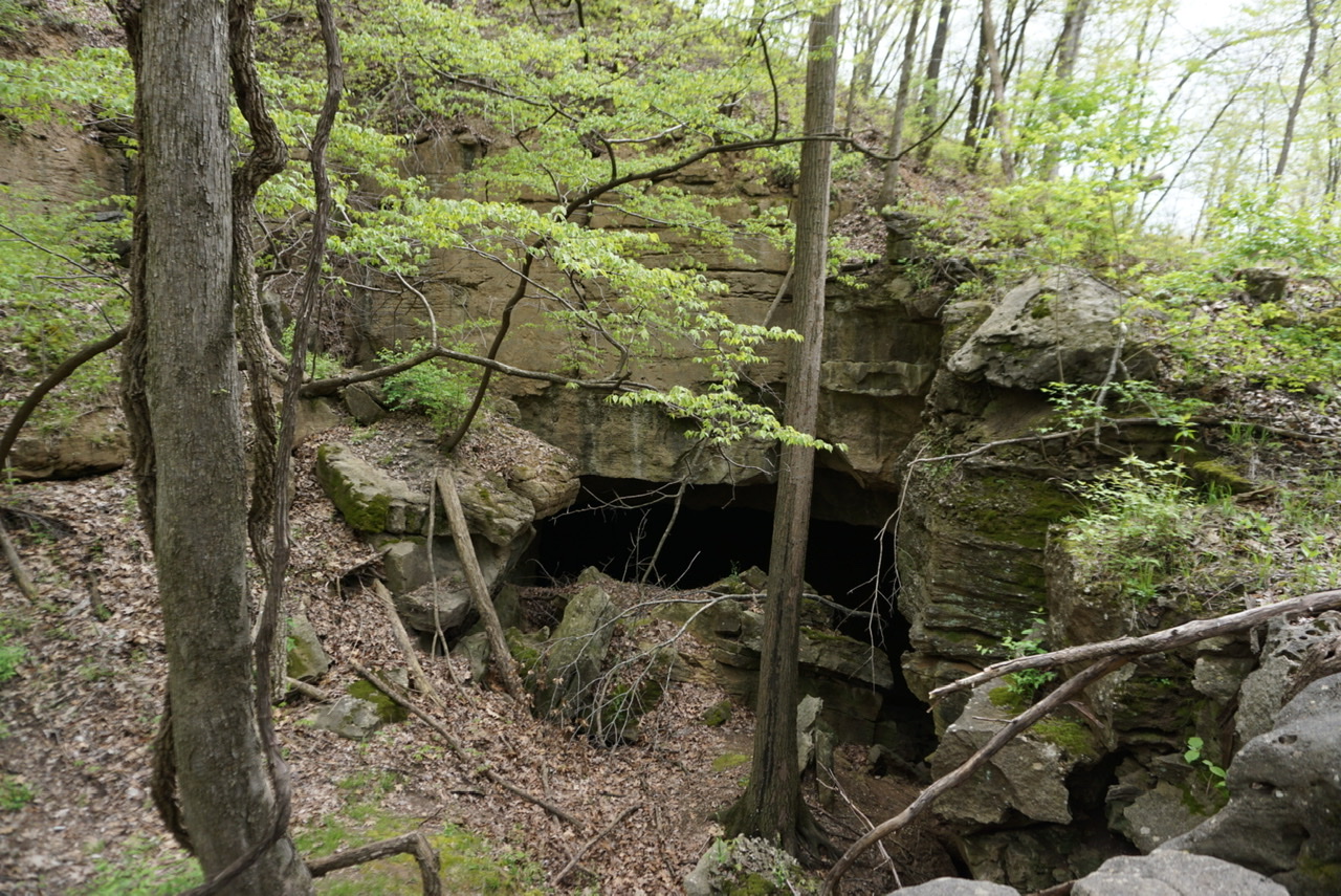
The Johnson Trail offers a different perspective of the bluffs looking from the bottom up. There are some slightly off-trail paths that offer some great looks. The refuse piles from the old mining operations also add some interest and tempt my curiosity.


I don’t know the history of the Salt Lick Point Land and Water Reserve. Clearly it was some sort of mine and many of the retired mine shafts are visible. No access is allowed to the mines and signs warn of repercussions for those who ignore them. But I do know that the trails are well-maintained, scenic, and provide fantastic variety in terrain and plant life. The trails are probably best explored in late fall, winter, or spring before the insects get bad. Mix together a little history, lots of scenery, and trails for all skill levels and I think we have a winner.

Trail map and driving directions here:


